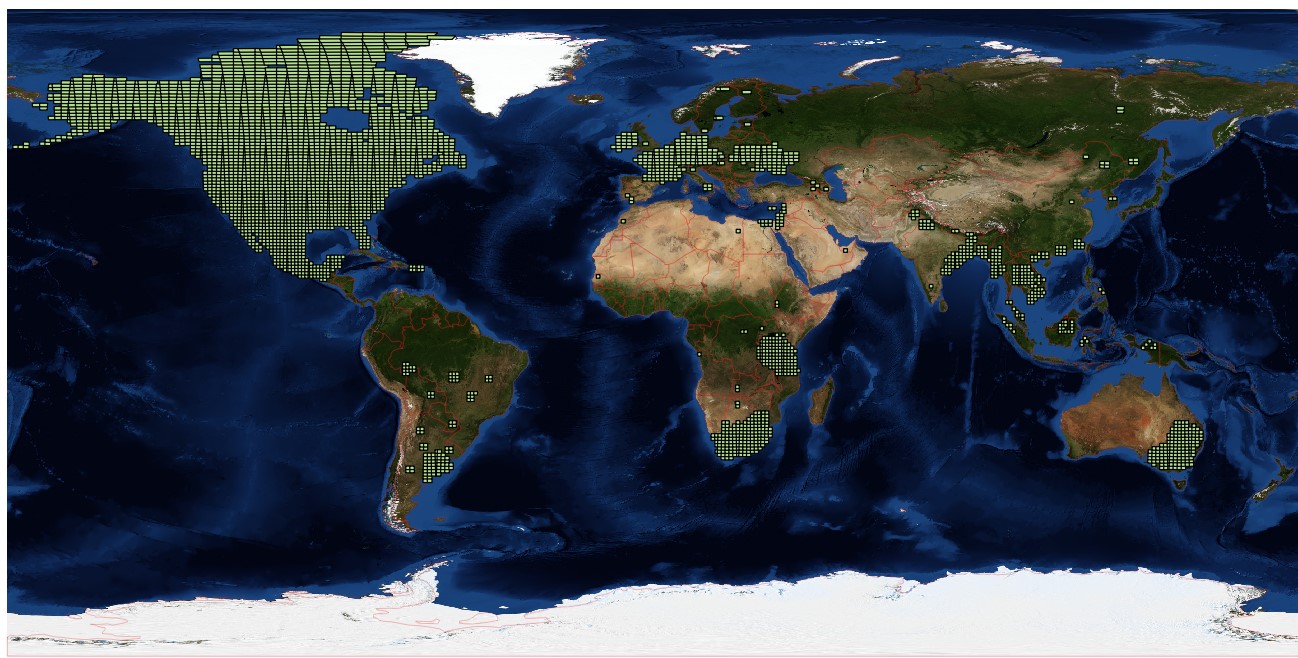
nasa_hls might help you to query, download and work with S30 and/or L30 data from NASA's Harmonized Landsat and Sentinel-2 project. If you are lucky, your area of interest is covered by the test sites (see also the map with available tiles).
The package comprises the following functionality:
- query the right scenes
- download scenes
- convert the HDF files (one per scene) in GeoTiff raster files (one per band)
- convert the bit-encoded Quality Assessment (QA) layer in a mask according to your needs
In case you have git installed you can install the package as follows:
pip install git+https://github.com/benmack/nasa_hls.git
If not and you have trouble to find a way, please open an issue.
You can also try the package out in a docker.
Run an interactive shell session with the current (host) working directory mounted to the WORKDIR/share folder of the container with:
docker run -it --rm -v ${PWD}:/home/hls/share benmack/nasa-hls:2020-08-23
Run a JupyterLab session with the current (host) working directory mounted to the WORKDIR/share folder of the container with:
docker run -p 8888:8888 -v ${PWD}:/home/hls/share benmack/nasa-hls-jupyterlab:2020-08-23
The logs should tell you where *The Jupyter Notebook is running at *, e.g. http://127.0.0.1:8888/lab.
Tutorials are available in the documentation of the package