The objective of our project is to transition from human-based observation to a camera-based system. Cameras have a much longer viewing distance than humans, and our system provides notifications much faster than manual methods, helping to avoid danger more effectively.

Our project has three main components:
- Wildfire Detection Pole: This pole is set up in the forest to detect fires.
- Data Center: It receives information from the Wildfire Detection Pole and sends it to the internet, allowing users to monitor the temperature and other data around the pole.
- Application: A mobile app that provides essential wildfire-related features and notifications.
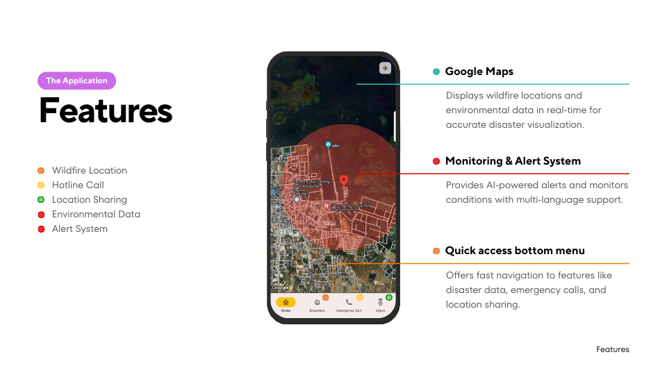
Our application includes five key features:
-
Wildfire Location
- The app displays the locations of active wildfires. For example, if there are wildfires in three places, it lists those locations for easy reference.
-
Hotline Call
- Users can directly call emergency hotlines from within the app.
-
Location Sharing
- Users can share their current location with others. For instance, if someone is in the forest during a wildfire, they can send their location to request help.
-
Environmental Data
- The app provides real-time data, including temperature, humidity, and gas levels around the pole.
-
Alert System
- If a wildfire is detected, a red circle appears on the map to indicate the affected area. Users within this red circle receive a notification sound, prompting them to evacuate the danger zone.
The Wildfire Detection Pole integrates the following components:
- Raspberry Pi Pico Board: Handles environmental sensors and initial data processing.
- Raspberry Pi 5 Board: Controls the camera and processes image data for object detection.
- Camera System: Rotates back and forth to scan the environment and detect wildfires.
- The Raspberry Pi 5 connects to the Raspberry Pi Pico and the camera, controlling the camera's rotation.
- The camera uses an object detection system to identify wildfires. When a wildfire is detected:
- The camera stops rotating and captures images of the wildfire.
- These images, along with temperature and humidity data, are sent to the Data Center.
- If no wildfires are detected:
- The camera continues rotating and pauses for 30 seconds after completing a full rotation.
- Temperature and humidity data are sent every 30 minutes.
- Data is encoded in two stages for efficiency
- Run-Length Encoding (RLE): Compresses the data to reduce size.
- Alphabet Replacement Encoding: Further compresses the RLE data for transmission.
- The encoded data is sent to the Data Center via the NRF module.
