| ideaSubmitFormInstruction | startDate | votingAllowed | newCampaign | status | commentCount | challenge-id | moderatorAdminOnlyIdeasEnabled | funnelId | ideaFromUnauthorizedMemberAllowed | tagline | groupName | hideIdeaAuthor | template | campaignAttributes | attributes | total-prize-awarded-cash | external-url | submission-end | why-use-prizes | submission-start | fiscal-year | public-voting-end-date | budget-and-resources | total-prize-offered-cash | campaign-owner | public-voting-start-date | legal-authority | total-number-of-prizes-awarded | evaluation-of-submissions | agency-id | solicitation-of-submissions | total-submission-received | total-number-of-participant | show-winners-instead-of-prizes | estimated-value-of-partner-contributions | non-monetary-incentives-awarded | partner-agencies-federal | judging-end-date | solicitation-methods | advancing-the-agency-mission | rules | submission-start-date-1 | hide-challenge-timeline | judging-start-date | winners-announced-date | cash-prizes-and-non-cash-prize-awards | campaign-owner-email | solution-type | partner-agencies-non-federal | original-post-id | total-number-of-winners-awarded | hosting | hide-challenge-funnel | type-of-challenge | participation-requirements | number-of-phases | how-to-enter | partnerships | groupAttributes | judging-criteria-description-0 | judging-criteria-percentage-0 | judging-criteria-0 | judging-criteria-description-1 | judging-criteria-percentage-1 | judging-criteria-1 | judging-criteria-description-10 | judging-criteria-percentage-10 | judging-criteria-10 | judging-criteria-description-11 | judging-criteria-percentage-11 | judging-criteria-11 | judging-criteria-description-12 | judging-criteria-12 | judging-criteria-percentage-12 | judging-criteria-description-13 | judging-criteria-13 | judging-criteria-percentage-13 | judging-criteria-percentage-14 | judging-criteria-14 | judging-criteria-description-14 | judging-criteria-percentage-15 | judging-criteria-15 | judging-criteria-description-15 | judging-criteria-16 | judging-criteria-percentage-16 | judging-criteria-description-16 | judging-criteria-17 | judging-criteria-percentage-17 | judging-criteria-description-17 | judging-criteria-description-18 | judging-criteria-percentage-18 | judging-criteria-18 | judging-criteria-description-19 | judging-criteria-percentage-19 | judging-criteria-19 | judging-criteria-description-2 | judging-criteria-2 | judging-criteria-percentage-2 | judging-criteria-description-3 | judging-criteria-3 | judging-criteria-percentage-3 | judging-criteria-percentage-4 | judging-criteria-4 | judging-criteria-description-4 | judging-criteria-percentage-5 | judging-criteria-5 | judging-criteria-description-5 | judging-criteria-6 | judging-criteria-percentage-6 | judging-criteria-description-6 | judging-criteria-7 | judging-criteria-percentage-7 | judging-criteria-description-7 | judging-criteria-description-8 | judging-criteria-percentage-8 | judging-criteria-8 | judging-criteria-description-9 | judging-criteria-percentage-9 | judging-criteria-9 | prize-description-0 | prize-cash-amount-0 | prize-name-0 | prize-description-1 | prize-cash-amount-1 | prize-name-1 | prize-cash-amount-10 | prize-name-10 | prize-description-10 | prize-cash-amount-11 | prize-name-11 | prize-description-11 | prize-name-12 | prize-cash-amount-12 | prize-description-12 | prize-name-13 | prize-cash-amount-13 | prize-description-13 | prize-description-14 | prize-cash-amount-14 | prize-name-14 | prize-description-15 | prize-cash-amount-15 | prize-name-15 | prize-description-16 | prize-name-16 | prize-cash-amount-16 | prize-description-17 | prize-name-17 | prize-cash-amount-17 | prize-cash-amount-18 | prize-name-18 | prize-description-18 | prize-description-2 | prize-name-2 | prize-cash-amount-2 | prize-description-3 | prize-name-3 | prize-cash-amount-3 | prize-cash-amount-4 | prize-name-4 | prize-description-4 | prize-cash-amount-5 | prize-name-5 | prize-description-5 | prize-name-6 | prize-cash-amount-6 | prize-description-6 | prize-name-7 | prize-cash-amount-7 | prize-description-7 | prize-description-8 | prize-cash-amount-8 | prize-name-8 | prize-description-9 | prize-cash-amount-9 | prize-name-9 | winner-solution-description-0 | winner-solution-link-0 | winner-name-0 | winner-solution-title-0 | winner-solution-link-1 | winner-solution-description-1 | winner-name-1 | winner-solution-title-1 | winner-solution-description-2 | winner-solution-link-2 | winner-solution-title-2 | winner-name-2 | winner-solution-link-3 | winner-solution-description-3 | winner-solution-title-3 | winner-name-3 | winner-name-4 | winner-solution-title-4 | winner-solution-description-4 | winner-solution-link-4 | winner-name-5 | winner-solution-title-5 | winner-solution-link-5 | winner-solution-description-5 | winner-solution-title-6 | winner-name-6 | winner-solution-description-6 | winner-solution-link-6 | winner-solution-title-7 | winner-name-7 | winner-solution-link-7 | winner-solution-description-7 | winner-solution-description-8 | winner-solution-link-8 | winner-name-8 | winner-solution-title-8 | winner-solution-link-9 | winner-solution-description-9 | winner-name-9 | winner-solution-title-9 | memberIdeaSubmissionAllowed | showTitle | description | campaignStatusName | templateId | stageStatistics | summaryEnabled | voteCount | ideaTabEnabledForChallenge | moderatorAdminOnlyIdeasNotificationEnabled | hideCommentAuthor | authorizedGroupIds | userSubscriptionAllowed | bannerImage | groupId | showTagline | challenge-title | privateCampaign | ideaCount | memberIdeaAttachmentAllowed | authorEdit | permalink | layout |
|---|---|---|---|---|---|---|---|---|---|---|---|---|---|---|---|---|---|---|---|---|---|---|---|---|---|---|---|---|---|---|---|---|---|---|---|---|---|---|---|---|---|---|---|---|---|---|---|---|---|---|---|---|---|---|---|---|---|---|---|---|---|---|---|---|---|---|---|---|---|---|---|---|---|---|---|---|---|---|---|---|---|---|---|---|---|---|---|---|---|---|---|---|---|---|---|---|---|---|---|---|---|---|---|---|---|---|---|---|---|---|---|---|---|---|---|---|---|---|---|---|---|---|---|---|---|---|---|---|---|---|---|---|---|---|---|---|---|---|---|---|---|---|---|---|---|---|---|---|---|---|---|---|---|---|---|---|---|---|---|---|---|---|---|---|---|---|---|---|---|---|---|---|---|---|---|---|---|---|---|---|---|---|---|---|---|---|---|---|---|---|---|---|---|---|---|---|---|---|---|---|---|---|---|---|---|---|---|---|---|---|---|---|---|---|---|---|---|---|---|---|---|---|---|---|---|---|---|---|---|---|---|---|---|---|---|---|---|---|---|
Create a challenge.gov account and upload your completed the submission form by 8:00 pm EST on March 1, 2016. This can be done through the "Submit Solution" button found at the top left of the page. After signing in to your challenge.gov account, fill in the submission title and upload the <a href="https://s3.amazonaws.com/challenge-gov/wp-content/uploads/2016/01/Submission-Form-1.docx" target="_blank">Submission Form</a> word document titled lastname.firstname. Note this should be the name of the student submitting a solution or the identified team leader. A completed <a href="https://s3.amazonaws.com/challenge-gov/wp-content/uploads/2016/01/Submission-Form-1.docx" target="_blank" rel="">Submission Form</a> must be one document that include: <ul> <li>Entrant details</li> <li>URL link to your visualization</li> <li>Project description (requirements for the project description can be found in the <a href="https://esri.app.box.com/vywgettingstartedguide" target="_blank" rel="attachment wp-att-112311">Getting Started Guide</a>)</li> </ul> <strong>Submission Requirements:</strong> Students must submit: <ol> <li>A completed project packet. This includes registration information, a description of the visualization with intended impact and the story it tells. All data and information sources used in the visualization must be provided and not exceed 5 pages (see <a href="https://esri.app.box.com/vywgettingstartedguide" target="_blank">Getting Started Guide</a>); and</li> <li>A web link to the visualization (students: make sure all data layers will be visible and are public).</li> </ol> Submissions will only be accepted to the Challenge.gov website. Submissions with incomplete registration information, project description or a lack of data citations will be disqualified. Use of credible and publicly available open data sets (both governmental and non-governmental) may be used. GIS software must be used for submissions. The geographic scale of the project can range from just a single local waterway up the entire watershed; clear and powerful analysis and presentation are more important than a specific geographic extent. |
2018-11-26T07:02:41 |
false |
false |
closed |
0 |
794 |
false |
4 |
true |
High school students are challenged to use open government data sources to create compelling, innovative, and comprehensible visualizations that inform individuals and communities about nutrient pollution and inspire them to reduce nutrient levels that cause algal blooms and hypoxia in local watersheds. |
Environmental Protection Agency |
false |
ideation |
03/01/2016 08:00 PM |
01/13/2016 12:00 AM |
FY16 |
$7,500 |
Denice Shaw |
Other |
222 |
No |
By making a submission to this challenge you: <ul> <li>Verify that you are a high school student and have approval from an appropriate sponsor;</li> <li>Give permission for your submission to be licensed under the <a href="http://creativecommons.org/" target="_blank">Creative Commons</a> Attribution License. This lets others distribute, tweak and build upon your work, even commercially, as long as they credit the original creation; and</li> <li>Agree to the following: <ul> <li>In order to receive an award, visualizations must be original works and there must be no legal obstacle to licensing under Creative Commons and information sources must be cited.</li> <li>Winners will be notified within a reasonable period of time after the judging phase has concluded and a verification process has occurred. The Challenge Organizers have absolute and sole discretion to determine whether to accept your submission. Meeting the criteria does not mean that the submission will be awarded. Once winners have been notified, they will work with Esri to make pre-publication revisions within 2 weeks. Winners will be required to sign an Esri release for publication in the Mapping the Nation book.</li> <li>The conference travel award will cover the cost for airfare, hotel and conference registration for one student and one guardian. The conference travel award must be used for attending the 2016 Esri Education Conference in San Diego, CA, and may be applied to transportation, lodging, and meals; conference registration fee will be waived. There are no substitutions to this prize.</li> <li>In case of a team winning a prize, the team captain is responsible for decisions on distributing prizes (monetary and non-monetary). Teams are responsible for costs associated with multiple attendees at the conference, though all conference registration fees for a winning team can be waived.</li> <li>Teams are comprised of only those individuals detailed on the registration form and designated as a team.</li> <li>After submission, changes will not be accepted.</li> <li>Prizes and awards: <ul> <li>Great Lakes Regional First Place Award will be: <ul> <li>Paid via check by GLOS;</li> <li>Subject to Federal income taxes; and</li> <li>Winner is responsible for consulting a tax adviser (1099 will not be sent).</li> <li>Payments will be made within 90 days of award announcement.</li> </ul> </li> <li>Grand Prize and Chesapeake Bay Regional First Place Award will be: <ul> <li>Paid via electronic funds transfer by EPA;</li> <li>Subject to Federal income taxes; and</li> <li>The EPA will comply with the Internal Revenue Service 1099 reporting requirements.</li> <li>Payments will be made within 90 days of award announcement.</li> </ul> </li> </ul> </li> </ul> </li> </ul> Challenge organizers have: <ul> <li>the right to verify each entrant’s eligibility and compliance with the above agreement; and</li> <li>sole discretion over awards (awards are not guaranteed).</li> </ul> |
No |
Denice Shaw |
Creative (design & multimedia) |
U.S. Geological Survey (USGS), Esri, Chesapeake Bay Foundation (CBF), Minnesota Sea Grant, Wisconsin Sea Grant, Center for Great Lakes Literacy (CGLL), Great Lakes Observing System (GLOS), and the National Geographic Society, with the assistance of the U.S. Department of Education (ED) |
97461 |
Hosted on this platform |
Yes |
Scientific |
Create a challenge.gov account and upload your completed the submission form by 8:00 pm EST on March 1, 2016. This can be done through the "Submit Solution" button found at the top left of the page. After signing in to your challenge.gov account, fill in the submission title and upload the <a href="https://s3.amazonaws.com/challenge-gov/wp-content/uploads/2016/01/Submission-Form-1.docx" target="_blank">Submission Form</a> word document titled lastname.firstname. Note this should be the name of the student submitting a solution or the identified team leader.
A completed <a href="https://s3.amazonaws.com/challenge-gov/wp-content/uploads/2016/01/Submission-Form-1.docx" target="_blank" rel="">Submission Form</a> must be one document that include:
<ul>
<li>Entrant details</li>
<li>URL link to your visualization</li>
<li>Project description (requirements for the project description can be found in the <a href="https://esri.app.box.com/vywgettingstartedguide" target="_blank" rel="attachment wp-att-112311">Getting Started Guide</a>)</li>
</ul>
<strong>Submission Requirements:</strong>
Students must submit:
<ol>
<li>A completed project packet. This includes registration information, a description of the visualization with intended impact and the story it tells. All data and information sources used in the visualization must be provided and not exceed 5 pages (see <a href="https://esri.app.box.com/vywgettingstartedguide" target="_blank">Getting Started Guide</a>); and</li>
<li>A web link to the visualization (students: make sure all data layers will be visible and are public).</li>
</ol>
Submissions will only be accepted to the Challenge.gov website. Submissions with incomplete registration information, project description or a lack of data citations will be disqualified. Use of credible and publicly available open data sets (both governmental and non-governmental) may be used. GIS software must be used for submissions. The geographic scale of the project can range from just a single local waterway up the entire watershed; clear and powerful analysis and presentation are more important than a specific geographic extent. |
Submissions will be evaluated for scientific credibility of data and use thereof. |
Scientific Excellence |
Submissions will be evaluated for effective combination, integration and application of data analysis. They must be original works but may use existing open applications. |
Data Analytics |
Submissions will be evaluated for a visually appealing, creative and intuitive interface. Submissions should be attractive while also providing a clear presentation of the data. |
Design |
Submissions will be evaluated for communicating a persuasive, meaningful, accurate and engaging message that is relevant across a broad viewership. If the visualization is watershed-, event- or variable-specific, it should have meaning, application and impact to other communities as well. |
Storytelling |
$2,500 prize, an opportunity to attend the Esri Education Conference in San Diego, CA in June 2016, and publication in Esri's "Mapping the Nation" book. The winner will also be publicized on USGS, EPA, Esri, GLOS, CBF, MN Sea Grant, and WI Sea Grant websites. |
2500 |
Grand Prize Award |
$2,500 prize and publication in Esri's "Mapping the Nation" book. The winner will also be publicized on USGS, EPA, Esri, GLOS, CBF, MN Sea Grant, and WI Sea Grant websites. |
2500 |
Chesapeake Bay Regional First Place Award |
$2,500 prize and publication in Esri's "Mapping the Nation" book. The winner will also be publicized on USGS, EPA, Esri, GLOS, CBF, MN Sea Grant, and WI Sea Grant websites. |
Great Lakes Regional First Place Award |
2500 |
Promotion on National Geographic's education website and a copy of the National Geographic "Atlas of the World." The winner will also be publicized on USGS, EPA, Esri, GLOS, CBF, MN Sea Grant, and WI Sea Grant websites. |
National Geographic Award |
Honorable Mention Award |
Publication in Esri's "Mapping the Nation" book. Winners will also be publicized on USGS, EPA, Esri, GLOS, CBF, MN Sea Grant, and WI Sea Grant websites. |
Honorable Mention Award |
Publication in Esri's "Mapping the Nation" book. Winners will also be publicized on USGS, EPA, Esri, GLOS, CBF, MN Sea Grant, and WI Sea Grant websites. |
Nicholas Oliveira |
Understanding Eutrophication in the Chesapeake Bay |
Alex Jin |
Nutrient Pollution, the Bay's Biggest Threat |
Algae Affliction of Lake Erie |
Ben Bratton |
Eutrophication in the Chesapeake Bay: Fertilizer and Manure |
Anna Lujan |
Clara Benadon |
The Chesapeake Bay: A National Treasure in Trouble |
Sam Hull |
The Bonds of Water |
false |
true |
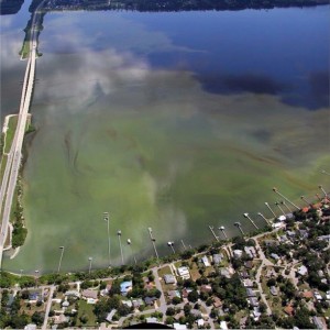
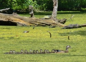
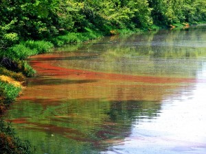
<p><span style="text-decoration: underline;"><strong>Visualize Your Water</strong></span></p> <p>Visualize Your Water is an exciting challenge that will equip high school students with new technology skills and help to broaden their understanding of nutrient pollution issues. Students will submit their best, most innovative visualization that tells a story about nutrient pollution in a local waterway.</p> <img class="wp-image-112291 size-medium alignleft" src="https://s3.amazonaws.com/challenge-gov/wp-content/uploads/2016/01/15409508130_9b311e928a_o-300x300.jpg" alt="Credit: Patricia M." width="300" height="300" /> <p style="text-align: left;"><span style="text-decoration: underline;"><strong>Background</strong></span></p> <p style="text-align: left;">Nutrient pollution is one of America’s most widespread and costly environmental problems. The U.S. Environmental Protection Agency, U.S. Geological Survey, Great Lakes Observing System, Esri (contributor of geographic information system (GIS) mapping software to the White House ConnectED Initiative), with assistance from the U.S. Department of Education, have come together to initiate the Visualize Your Water challenge. This Challenge seeks to engage the innovative spirit of high school students in the Great Lakes and Chesapeake Bay watershed states to create compelling visualizations about nutrient pollution using GIS software and water quality data collected by federal, state and local efforts. The Visualize Your Water Challenge will help students cultivate career-oriented skills and learn about local nutrient pollution issues while encouraging environmental stewardship. This Challenge continues the work of the Challenging Nutrients Coalition, a coalition of federal agencies and non-governmental organizations, to improve our ability to measure, understand and reduce nutrient pollution.</p> <strong>How do teachers get involved?</strong> This challenge is an opportunity to bring GIS and water quality education into the classroom! Teachers can use this challenge in or out of the class room, and provide students the opportunity to engage (singly or in teams) with an important environmental issue (water quality) and a robust technology for visualization and analysis (GIS). <strong>Where to begin? </strong>The <a href="https://esri.app.box.com/vywgettingstartedguide" target="_blank" rel="attachment wp-att-112311">Getting Started Guide</a> provides students and teachers with resources and instruction on how to use digital mapping technology to prepare submission and how to enter the Visualize Your Water Challenge. <ul> <li><strong>Get Started:</strong> <ol> <li>Request your free ArcGIS Online School account for access to free software <a href="http://www.esri.com/connected" target="_blank">HERE.</a></li> <li>Learn about GIS and nutrient pollution by checking out the <a href="https://esri.app.box.com/vywgettingstartedguide" target="_blank">Getting Started Guide.</a></li> <li style="text-align: left;">Create your solution!</li> <li style="text-align: left;">Submit your solution and submission form.</li> <li style="text-align: left;">Note the submission confirmation in your browser window.</li> </ol> </li> </ul> <p ><strong>Introductory Resources</strong></p> <p><a href="https://www.youtube.com/watch?v=vCicSNnKUvM" target="_blank">U.S. EPA video on Nutrient Pollution</a></p> <p><a href="https://www.govloop.com/resources/story-mapping-chesapeake%E2%80%8B/" target="_blank">Story Mapping Environmental Success in the Chesapeake </a></p> <p ><a href="http://www.cgll.org/for-educators/webinar-archive/visualize-your-water-challenge-webinar/" target="_blank">Visualize Your Water Challenge Webinar</a></p> <p>Any use of trade, firm, or product names is for descriptive purposes only and does not imply endorsement by the U.S. Government.</p> <p><strong>See <a href="https://esri.app.box.com/vywgettingstartedguide" target="_blank">Getting Started Guide</a> for the full list of resources.</strong></p> <p><strong>Have a question? </strong>See <a href="https://esri.app.box.com/vywfaq" target="_blank">Frequently Asked Questions</a> or contact [email protected]</p> <img class="wp-image-112281 size-medium" src="https://s3.amazonaws.com/challenge-gov/wp-content/uploads/2016/01/15409013498_8d4f709f80_o-300x215.jpg" alt="Credit: Patricia M." width="300" height="215"/><br> Credit: Patricia M. <p style="text-align: left;"><span style="text-decoration: underline;"><strong>Timeline:</strong></span></p> <p style="text-align: left;">Competition Begins --january 13th, 2016</p> <p style="text-align: left;">Submissions Due --- March 1st, 2016 by 8 pm EST</p> <p style="text-align: left;">Judging --- Ends mid-March 2016</p> <p style="text-align: left;">Winners Announced --- April 2016</p> <p style="text-align: left;"><span style="text-decoration: underline;"><strong>Eligibility:</strong></span></p> <p style="text-align: left;">High School Students in the following US states are eligible to participate:</p> <ul> <li style="text-align: left;"><strong>Great Lakes Basin:</strong> Illinois, Indiana, Michigan, Minnesota, New York, Ohio, Pennsylvania, Wisconsin</li> <li style="text-align: left;"><strong>Chesapeake Bay Watershed:</strong> Delaware, District of Columbia, Maryland, New York, Pennsylvania, Virginia, West Virginia</li> </ul> To be considered for an award, entrants must be a high school student in one of the designated states and sponsored by a teacher at their high school. Home school students are welcome to enter, and in this case, guardians act as a sponsor. Teams are allowed as long as there is an identified team leader. If a prize is awarded to a team, it will be provided to the team leader. <p><strong>Join the conversation with #VizUrWater</strong></p> <p><strong>Have a question? Check out the <a href="https://esri.app.box.com/vywfaq" target="_blank">FAQs</a></strong></p> <p ><strong>Contact: [email protected]</strong></p> <a href="https://www.challenge.gov/?attachment_id=112321" rel="attachment wp-att-112321"><img class="wp-image-112321 size-medium" src="https://s3.amazonaws.com/challenge-gov/wp-content/uploads/2016/01/15595959392_6580f5fd9f_o-300x225.jpg" alt="Credit: Diana L." width="300" height="225" /></a><br> Credit: Diana L. <p ><span style="text-decoration: underline;"><strong>Visualize Your Water Challenge Collaborators:</strong></span></p> <p><a href="http://www.cgll.org/" target="_blank">Center for Great Lakes Literacy</a></p> <p ><a href="http://www.cbf.org/" target="_blank">Chesapeake Bay Foundation</a></p> <p><a href="http://www.esri.com/" target="_blank">Esri</a></p> <p><a href="http://glos.us/" target="_blank">Great Lakes Observing System</a></p> <p><a href="http://www.seagrant.umn.edu/" target="_blank">Minnesota Sea Grant</a></p> <p ><a href="http://nationalgeographic.org/" target="_blank">National Geographic Society</a></p> <p><a href="http://www.epa.gov/" target="_blank">U.S. Environmental Protection Agency</a></p> <p><a href="http://www.usgs.gov/" target="_blank">U.S. Geological Survey</a></p> <p ><a href="http://seagrant.wisc.edu/" target="_blank">Wisconsin Sea Grant</a></p> |
Launched |
0 |
false |
0 |
true |
false |
false |
false |
18 |
true |
Visualize Your Water |
true |
0 |
false |
false |
/challenge/visualize-your-water/ |
json-page |